

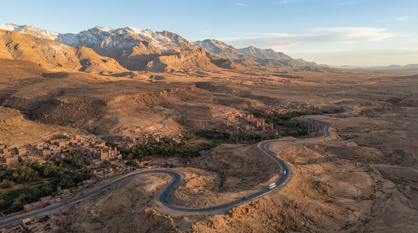
Why Geography Is Your First Planning Decision
Most Morocco itinerary mistakes happen before a single booking is made. Travelers see a map, pick four cities that look close together, and underestimate every road between them. Morocco's terrain punishes that assumption. The Atlas Mountains don't just look impressive - they physically separate the country's north from its south, add hours to overland journeys, and create climate zones that can mean a 40-degree temperature difference between Fez and Ouarzazate in the same week.
Before deciding how many cities to include, it helps to understand what each region actually involves - not just its highlights, but its infrastructure, its seasonal patterns, and its distance from everywhere else. That's the same logic behind building a well-structured itinerary: geography shapes the skeleton that everything else hangs on.
8-10 hrs
Drive time from Marrakech to Merzouga (Sahara)
Road distance through the Atlas Mountains via the Draa Valley; no direct rail connection exists to the desert region.
13,671 ft
Elevation of Jebel Toubkal, High Atlas
The highest peak in North Africa outside the broader Atlas system, located roughly 40 miles south of Marrakech.
~40°F
Typical temperature gap between north and south Morocco
Temperature differences between northern cities like Fez and pre-Saharan towns like Erfoud can exceed this in winter months.
The Four Geographic Zones and What They Mean Logistically
The Coasts
Morocco's Atlantic coastline runs from Tangier in the north to Dakhla in the far south. Cities like Casablanca, Rabat, and Essaouira sit along this stretch and benefit from Morocco's best transportation infrastructure - rail, highways, and major airports. The Mediterranean coast in the northeast is shorter and less developed for tourism but includes the port city of Al Hoceima and access to the Rif Mountains.
The Rif and Atlas Mountains
The Rif range in the north is home to Chefchaouen, one of Morocco's most visited towns. The Middle and High Atlas ranges run diagonally through the country's interior. Roads here are often narrow, winding, and slow. The High Atlas is also where you'll find Toubkal, North Africa's highest peak, a destination that draws trekkers but demands preparation and realistic time budgets.
The Interior Plains and Imperial Cities
The Fez-Meknes-Rabat corridor sits on Morocco's interior plains - relatively flat, well-connected, and historically rich. This region is the most efficient to cover, with rail links between all three cities and a strong base of guesthouses and local guides.
The Pre-Saharan South
The road south from Marrakech through Ouarzazate, the Draa Valley, and into the Tafilalet region ends near Merzouga and the Erg Chebbi dunes. This route is long, dramatic, and logistically standalone. Budget a minimum of three days for a Marrakech-desert round trip to avoid spending most of your time in transit.
Seasonal Realities That Maps Don't Show
Morocco's geography creates climate extremes that vary more than most travelers expect. The north and coast are best visited in spring (March-May) and fall (September-November), when temperatures are moderate. The High Atlas can see snow from November through March, occasionally closing the Tizi n'Tichka pass - the main road between Marrakech and Ouarzazate.
The pre-Saharan south is most comfortable from October through April. Summer temperatures in the desert region can exceed 110°F, which makes outdoor exploration genuinely dangerous, not just uncomfortable. Winter in the mountains can be severe, particularly at elevation.
Build Travel Days Into Your Schedule Explicitly
In Morocco, never count a travel day as a sightseeing day. Long overland transfers - especially on mountain roads heading south - are genuinely tiring and rarely on schedule. Block travel days on your calendar as transit-only, and treat any sightseeing that happens as a bonus rather than a requirement.
Understanding these patterns before you set an itinerary is the difference between a flexible, enjoyable trip and a schedule full of contingencies. For readers new to this level of planning, starting with the fundamentals before committing to complex routes is worth the extra preparation time.
Reading Morocco's Regions Like a Traveler, Not a Tourist
The difference between a rushed Morocco trip and a well-paced one is usually an honest reckoning with distance. Fez to Chefchaouen looks like a short hop on Google Maps - it's roughly 2.5 to 3 hours by road through winding terrain, not 1.5 hours as a straight line would suggest. Marrakech to Essaouira is under 120 miles but takes about 2.5 hours each way, making it a viable day trip only if you're comfortable spending half your day in a car.
Developing this kind of ground-level geographic literacy is a habit shared by experienced travelers. Reading a destination like a local means calibrating your expectations with real conditions, not idealized ones. In Morocco, that means checking road quality, confirming transport options before you're committed, and building buffer days rather than assuming you can swap plans on the fly.
Morocco rewards travelers who understand what the map is actually telling them. Its geographic diversity - from the Atlantic coast to the Saharan edge - is part of what makes it a genuinely remarkable destination. The logistics are manageable; they just require honest planning.
This article is for general informational purposes only. Travel conditions, entry requirements, and safety advisories can change. Always verify visa rules, border policies, and safety information with official government sources - including the US State Department and the Moroccan government - before traveling.
Frequently Asked Questions
The drive from Marrakech to Merzouga, the most common Sahara gateway, takes roughly 8-10 hours by road through the Atlas Mountains and the Draa Valley. Many travelers break this into two days with an overnight stop in Ouarzazate or Boumalne Dades. There is no direct rail connection to the desert region.
Yes, significantly. The north - including Tangier, Chefchaouen, and Fez - has a Mediterranean climate with mild, rainy winters and warm summers. The south, including the pre-Saharan zone, is arid year-round and can reach extreme heat (over 100°F) from June through August. The Atlas Mountains act as a weather barrier between these two zones.
Morocco's national rail network (ONCF) connects major coastal and northern cities well - Casablanca, Rabat, Meknes, Fez, Tangier, and Marrakech all have service. However, the rail network does not extend to the south, the Rif Mountains, or the Sahara. Those areas require buses, shared taxis, or private transport.
That depends entirely on how much time you have and what you want to see. Most first-time itineraries anchor on Marrakech or the Fez-Meknes-Rabat imperial city corridor, both of which offer strong infrastructure and accessible attractions. From either base, day trips or short extensions into the mountains or coast are practical.
As of the most recent publicly available guidance, US citizens can enter Morocco visa-free for stays up to 90 days. Requirements can change; always verify with the official Moroccan government or US State Department before travel.
Morocco is generally considered safe for independent travelers, though conditions vary by region and change over time. Check the current US State Department travel advisory and register with the Smart Traveler Enrollment Program (STEP) before departure. Exercise standard precautions, particularly in crowded medinas and border regions.
The content provided on our blog site traverses numerous categories, offering readers valuable and practical information. Readers can use the editorial team’s research and data to gain more insights into their topics of interest. However, they are requested not to treat the articles as conclusive. The website team cannot be held responsible for differences in data or inaccuracies found across other platforms. Please also note that the site might also miss out on various schemes and offers available that the readers may find more beneficial than the ones we cover.